After reading a short piece about the Mississippi River and the Great Flood of 1993, I thought the fifth graders would be interested in seeing some images and reading a bit more about the flooding that year.
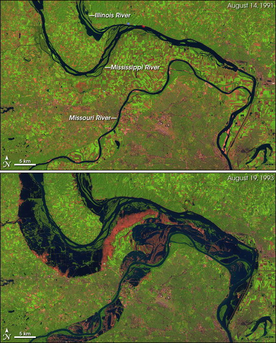
Here you can see satellite images that compare the amount of water usually in the Mississippi, Illinois, and Missouri Rivers and the amount of water during the flood.
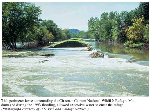
Here is a good example of a broken levee. There was so much rain that spring and summer, that sometimes the water flowed over the levees which then washed them out. Sometimes the pressure from the water caused a break to happen. Then the water would flow through the break and wash away more of the levee. In the background you can see the levee that was not broken.
Many more images can be found at this simple Google Image search, but the picture below shows how the flooding affected cities. This is Dubuque, Iowa which is located just across the Mississippi River from the southwest corner of Wisconsin. You can see the bridge that crosses the river, but it is hard to see where the actual river is.
For additional reading, here an article on Wikipedia about the 1993 flood: Great Flood of 1993
Here is an article written last year on the twentieth anniversary of the flood: Mississippi River Flood, 1993
Thursday, March 13, 2014
Tuesday, March 4, 2014
United States Population
Hey, fifth graders! Since we have been studying population, I thought we should take a look at the United States Census Bureau's "population clock." It shows both the United States population and the world population. It also shows how the population of both is changing.
If you click here you can see even more information like which states and cities have the highest population. You can even look up the United States' population on any given day in history. Pretty cool stuff.
Subscribe to:
Comments (Atom)


